Publications
List of publications.
2024
-
 More eyes on the road: Sensing flooded roads by fusing real-time observations from public data sourcesPranavesh Panakkal, and Jamie Ellen PadgettReliability Engineering & System Safety, 2024
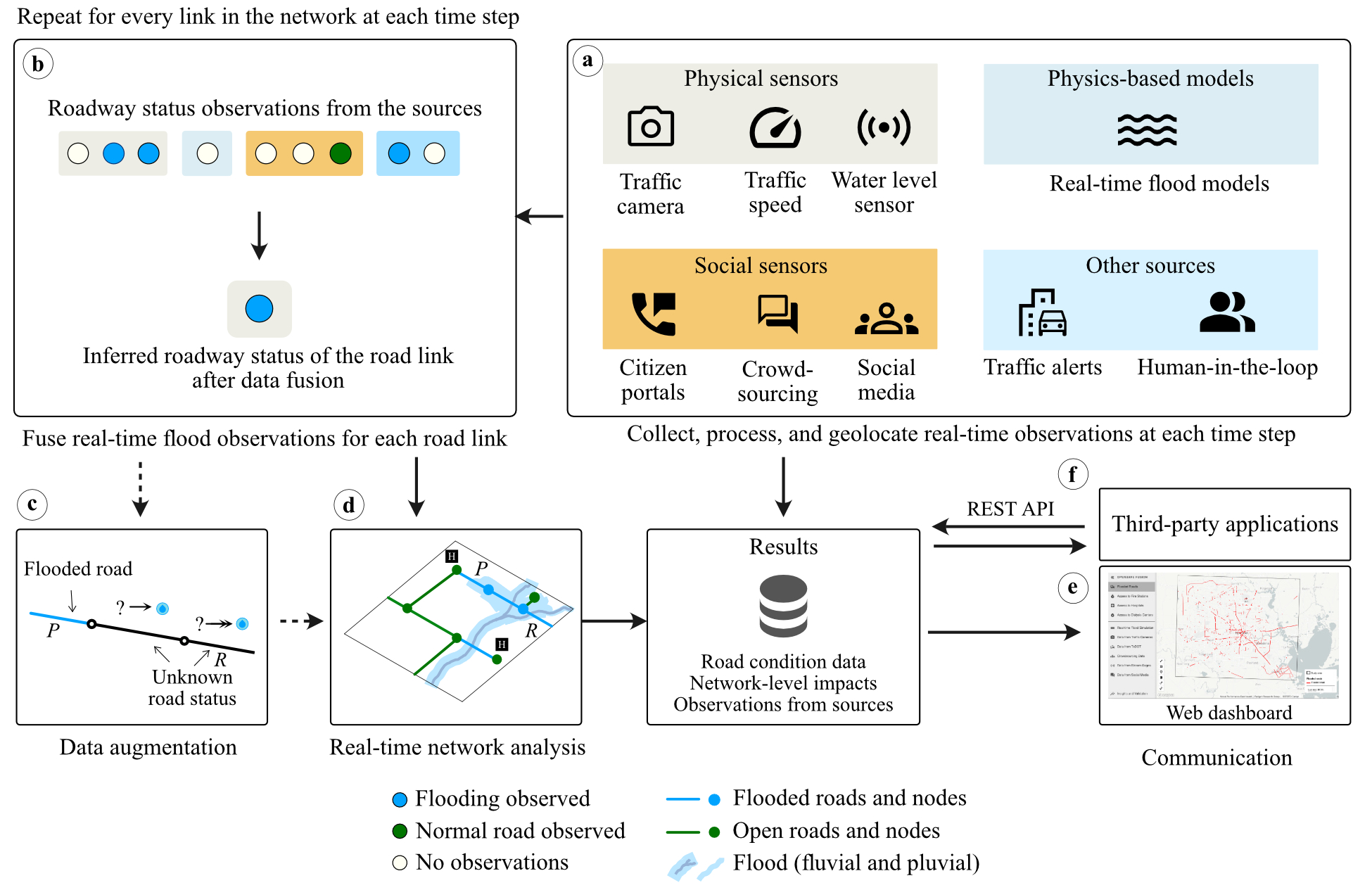
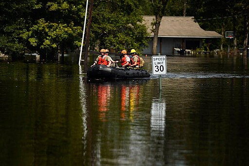
Reliable sensing of road conditions during flooding can facilitate safe and efficient emergency response, reduce vehicle-related fatalities, and enhance community resilience. Existing situational awareness tools typically depend on limited data sources or simplified models, rendering them inadequate for sensing dynamically evolving roadway conditions. Consequently, roadway-related incidents are a leading cause of flood fatalities (40%–60%) in many developed countries. While an extensive network of physical sensors could improve situational awareness, they are expensive to operate at scale. This study proposes an alternative—a framework that leverages existing data sources, including physical, social, and visual sensors and physics-based models, to sense road conditions. It uses source-specific data collection and processing, data fusion and augmentation, and network and spatial analyses workflows to infer flood impacts at link and network levels. A limited case study application of the framework in Houston, Texas, indicates that repurposing existing data sources can improve roadway situational awareness. This framework offers a paradigm shift for improving mobility-centric situational awareness using open-source tools, existing data sources, and modern algorithms, thus offering a practical solution for communities. The paper’s contributions are timely: it provides an equitable framework to improve situational awareness in an epoch of climate change and exacerbating urban flood risk.
@article{panakkal2024more,
  title = {More eyes on the road: Sensing flooded roads by fusing real-time observations from public data sources},
  author = {Panakkal, Pranavesh and Padgett, Jamie Ellen},
  journal = {Reliability Engineering \& System Safety},
  pages = {110368},
  year = {2024},
  publisher = {Elsevier},
}
2023
-
 ISLAND: Informing Brightness and Surface Temperature Through a Land Cover-based InterpolatorYuhao Liu, Pranavesh Panakkal, Sylvia Dee, and 3 more authorsarXiv preprint arXiv:2309.12416, 2023
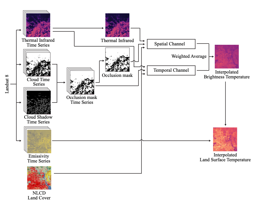
Cloud occlusion is a common problem in the field of remote sensing, particularly for thermal infrared imaging. Remote sensing thermal instruments onboard operational satellites are supposed to enable frequent and high-resolution observations over land; unfortunately, clouds adversely affect thermal signals by blocking outgoing longwave radiation emission from Earth’s surface, interfering with the retrieved ground emission temperature. Such cloud contamination severely reduces the set of serviceable thermal images for downstream applications, making it impractical to perform intricate time-series analysis of land surface temperature (LST). In this paper, we introduce a novel method to remove cloud occlusions from Landsat 8 LST images. We call our method ISLAND, an acronym for Informing Brightness and Surface Temperature Through a Land Cover-based Interpolator. Our approach uses thermal infrared images from Landsat 8 (at 30 m resolution with 16-day revisit cycles) and the NLCD land cover dataset. Inspired by Tobler’s first law of Geography, ISLAND predicts occluded brightness temperature and LST through a set of spatio-temporal filters that perform distance-weighted spatio-temporal interpolation. A critical feature of ISLAND is that the filters are land cover-class aware, making it particularly advantageous in complex urban settings with heterogeneous land cover types and distributions. Through qualitative and quantitative analysis, we show that ISLAND achieves robust reconstruction performance across a variety of cloud occlusion and surface land cover conditions, and with a high spatio-temporal resolution. We provide a public dataset of 20 U.S. cities with pre-computed ISLAND thermal infrared and LST outputs. Using several case studies, we demonstrate that ISLAND opens the door to a multitude of high-impact urban and environmental applications across the continental United States.
@article{liu2023island, title = {ISLAND: Informing Brightness and Surface Temperature Through a Land Cover-based Interpolator}, author = {Liu, Yuhao and Panakkal, Pranavesh and Dee, Sylvia and Balakrishnan, Guha and Padgett, Jamie and Veeraraghavan, Ashok}, journal = {arXiv preprint arXiv:2309.12416}, year = {2023}, } -
 Safer this way: Identifying flooded roads for facilitating mobility during floodsPranavesh Panakkal, Allison M. Wyderka, Jamie E. Padgett, and 1 more authorJournal of Hydrology, 2023
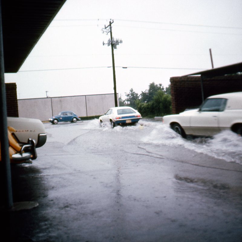
Severe storms and associated flooding pose a significant risk to urban mobility. Consequently, 40 to 63 percent of flood-related deaths are linked to roadway-related incidents in developed countries. The dynamic nature of flooding and the lack of real-time information make it challenging to sense flooding and its impact on roadways. Hence, existing state-of-the-art methods fall short of providing a robust, reliable, and affordable tool to facilitate situational awareness during storms. Such a tool is indispensable to aid emergency response, especially considering the potential increase in risk to flood exposure due to climate change and other factors. This study addresses this need by providing an open-source framework that couples real-time rainfall data, a physics-based flood model, and network and spatial analyses to sense real-time flood impact on the road transportation system. Case studies using three recent storms in Houston, Texas demonstrate the framework’s ability to provide vehicle-class specific roadway conditions for even minor roads and residential streets—a problem existing approaches struggle with. Aside from road-link conditions, the framework can also estimate network-level flood impacts, such as identifying regions without access to critical facilities like hospitals, giving decision-makers a more holistic view of network performance. Further, the framework is interoperable with existing situational awareness tools and could augment their ability to sense road conditions during flooding. Finally, the proposed framework can equip flood-prone communities and emergency responders with reliable and accessible situational awareness content using open-source tools and data to promote safer mobility during flooding—a key goal of intelligent transportation systems.
@article{PANAKKAL2023130100, title = {Safer this way: Identifying flooded roads for facilitating mobility during floods}, journal = {Journal of Hydrology}, pages = {130100}, year = {2023}, issn = {0022-1694}, doi = {https://doi.org/10.1016/j.jhydrol.2023.130100}, author = {Panakkal, Pranavesh and Wyderka, Allison M. and Padgett, Jamie E. and Bedient, Philip B.}, } -
 Sensing Flooded Roads to Support Roadway Mobility during Flooding: A Web-Based Tool and Insights from Needs Assessment InterviewsNatural Hazards Review, 2023
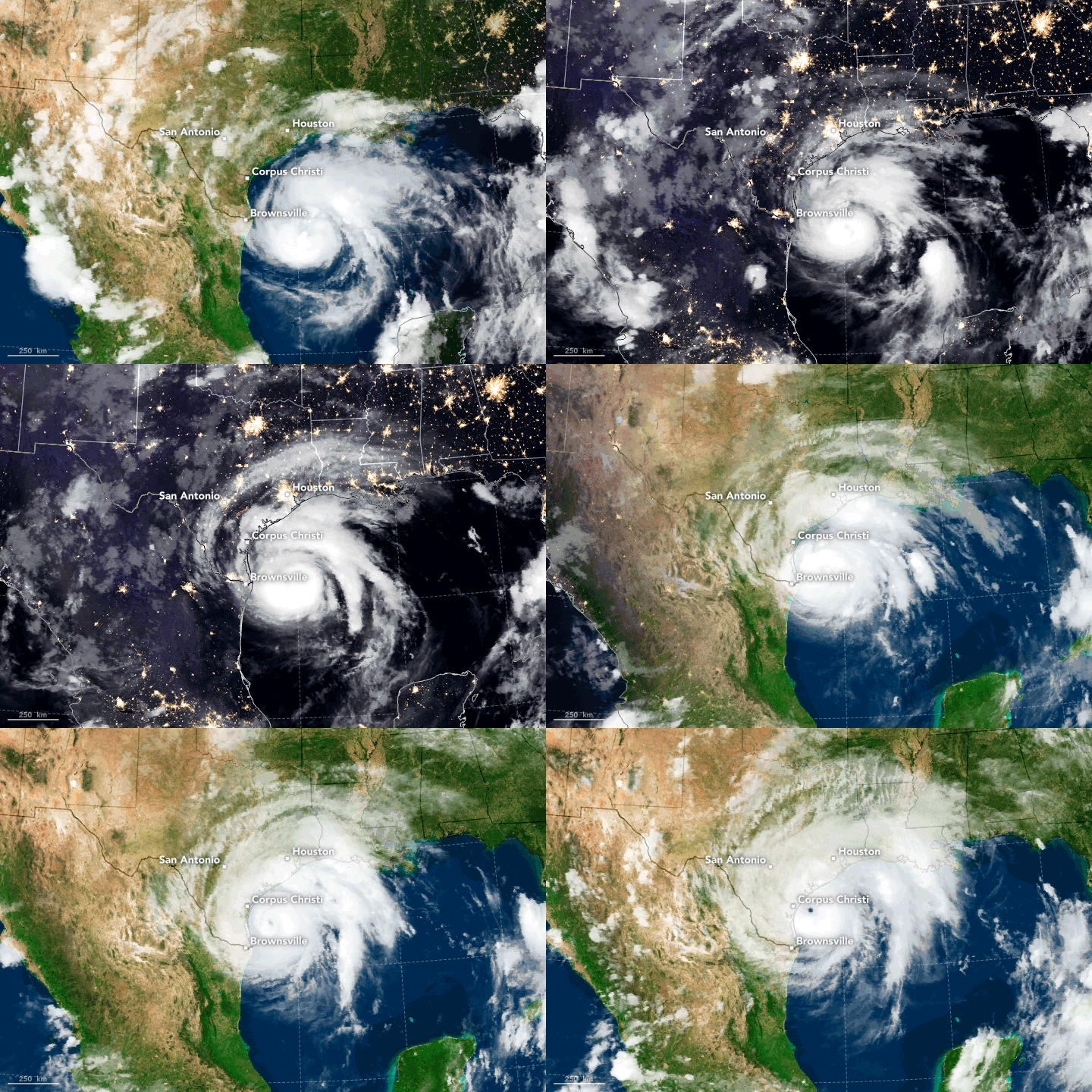
Reliable sensing of roadway conditions during flooding is a long-standing, challenging problem with societal importance for roadway safety. Tools that provide real-time data on road conditions during floods can facilitate safer mobility, reduce vehicle-related drownings, enhance flood response efficiency, and support emergency response decision-making. Following the tenets of user-centered design, such tools ideally should address the needs of diverse stakeholders involved in flood response. Currently, the existing literature lacks a thorough understanding of stakeholder needs to guide situational awareness tool development in the area of roadway mobility during flood events. This paper addresses this gap by studying the needs of stakeholders responsible for managing flood response in Houston. Semi structured one-on-one interviews were conducted with stakeholders from different Houston-based organizations responsible for managing and responding to flood hazard events in the downtown metropolitan area. Interview responses were systematically analyzed to identify (1) data needs for facilitating efficient and safe emergency response, (2) the most and least valuable information available during flooding, (3) communication and visualization strategies, (4) factors influencing stakeholder trust, and (5) factors influencing occupational stress during flood response. Finally, interview insights were used to develop a conceptual situational awareness framework and a prototype map-based tool that provides real-time road condition data during flood events. This study elucidates vital information for improving existing tools and providing preliminary guidance for future mobility-centric situational awareness tools that promote safer mobility and facilitate emergency response decision-making during flooding. Although the study focused on Houston, insights gained may be useful for comparable flood-prone regions. In developed countries, 40–60 percent of flood fatalities are attributed to vehicle-related incidents. Flooded roads and lack of real-time road condition data pose safety risks to first responders and reduce emergency response efficiency. Understanding stakeholder needs and developing tools that address them are essential for improving the safety and efficiency of emergency response, especially considering a potential increase in flood risk to urban mobility due to climate change and other factors. Following the tenets of the user-centered design process, this study identified stakeholder needs, conceptualized a framework for sensing road conditions, and developed an open-source prototype tool in the context of flood response in Houston. Insights gained in this study can improve the efficacy of existing mobility-centric situational awareness tools and provide preliminary guidance for quick prototyping of new situational awareness tools. Furthermore, organizations can use the insights presented here to help reduce work-related stress among emergency response personnel, thereby improving emergency response efficiency and organizational resilience.
@article{panakkal_sensing_2023,
  author = {Panakkal, Pranavesh and Fattoracci, Elisa S. M. and Padgett, Jamie E. and King, Danielle D. and Yoo, Teddi},
  title = {Sensing Flooded Roads to Support Roadway Mobility during Flooding: A Web-Based Tool and Insights from Needs Assessment Interviews},
  journal = {Natural Hazards Review},
  volume = {24},
  number = {4},
  pages = {04023039},
  year = {2023},
  doi = {10.1061/NHREFO.NHENG-1753},
  url = {https://ascelibrary.org/doi/abs/10.1061/NHREFO.NHENG-1753},
}
2022
-
 Situational awareness frameworks for real-time sensing of flood impacts on road transportation networksPranavesh PanakkalRice University, 2022
Severe storms and associated flooding pose a significant risk to roadway mobility. Consequently, 40 to 60% of flood-related deaths are attributed to vehicle-related incidents in developed countries. A real-time situational awareness framework that can sense road conditions can facilitate safer mobility, reduce vehicle-related drownings, enhance flood response efficiency, and support emergency response decision-making. Existing situational awareness tools, which often depend on limited data sources and show acceptable performance in limited case studies, fall short of providing a comprehensive framework for sensing flood impacts on roads. Particularly, opportunities to significantly improve situational awareness by leveraging existing data sources in urban regions remain untapped. This thesis addresses this need by offering new tools, models, methodologies, and frameworks for detecting flood impacts on roads in real time and advances the current state-of-the-art for sensing roadway conditions during floods. First, this thesis reports results from semi-structured one-on-one needs assessment interviews with stakeholders responsible for managing flood response in Houston. Specifically, it reports situational awareness data needs for facilitating efficient and safe emergency response, most and least valuable information for situational awareness, communication and visualization strategies, and factors influencing stakeholder trust. These insights inform the methodological underpinning of the three situational awareness frameworks proposed in this thesis. The first situational awareness framework proposed in this thesis senses flood impacts on infrastructure using precompiled maps and real-time rainfall data. The framework offers basic situational awareness information accessible to most communities and is appropriate for areas with limited resources. Relying on precompiled maps to sense real-time flood impacts is often insufficient. This study proposes Open Source Situational Awareness Framework for Mobility (OpenSafe Mobility) to provide a more comprehensive sensing of flood impacts on roads. OpenSafe Mobility uses real-time rainfall data, a physics-based flood model, spatial and network analyses, and vehicle characteristics to sense real-time flood impact on the road transportation system. Case studies using three recent storms in Houston, Texas, demonstrate the framework’s ability to provide vehicle-class specific roadway conditions for even minor roads and residential streets–a problem existing approaches struggle with. While OpenSafe Mobility case studies highlight its ability to model flood impacts, it also provides evidence that depending on only one source for sensing flood impacts is insufficient. An alternative is to leverage multiple sources in a data fusion framework to sense current flood conditions. This thesis proposes Open Source Situational Awareness Framework for Mobility using Data Fusion (OpenSafe Fusion) to take advantage of this opportunity. First, OpenSafe Fusion identifies different data sources that either directly or indirectly observe flooding in the study region. Next, source-specific data collection and processing workflows are developed, leveraging diverse techniques from spatial analysis to deep learning. The observations from the sources are then combined in real-time using data fusion techniques explicitly accounting for data source characteristics. Case studies using recent storms in Houston, Texas, demonstrate the framework’s ability to significantly improve situational awareness data availability and provide reliable estimates of road conditions using existing public data sources. Finally, this thesis uses OpenSafe Fusion to develop a new prototype web tool for Houston that provide real-time road conditions data for enhancing mobility-centric situational awareness. The proposed tool addresses essential stakeholder needs identified during needs assessment interviews. Overall, this thesis provides new tools, models, methodologies, and frameworks to sense flood impacts on roads in real time and quantify network-level impacts of flooding. Applying the methodologies presented in this thesis will significantly improve situational awareness during flooding. Specifically, it will enable emergency responders and decision-makers to identify flooded roads and safer routes, locate isolated communities, reduce delays and detours, and aid equipment selection. In conclusion, the contributions of this thesis have societal importance in enhancing emergency response efficiency and road safety. These contributions are significant and timely considering the potential increase in flood risk to roadway mobility due to climate change and other factors.
@phdthesis{panakkal2022situational, author = {Panakkal, Pranavesh}, title = {Situational awareness frameworks for real-time sensing of flood impacts on road transportation networks}, school = {Rice University}, year = {2022}, } -
 Infrastructure impacts and vulnerability to coastal flood eventsJamie E. Padgett, Pranavesh Panakkal, and Catalina González-DueñasIn Coastal Flood Risk Reduction, 2022
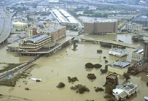
This chapter provides an overview of the impacts of coastal flood events, namely, tropical storms and hurricanes, on coastal infrastructure, leveraging examples from industrial and transportation infrastructure. We emphasize the multihazard nature of coastal storm events, producing wind, storm surge, waves, and rainfall, and their impacts on the built environment. Such multihazard events can impair the functionality of infrastructure in the short term due to inundation, as well as over longer periods due to damage requiring repair or replacement. Furthermore, these events can have cascading consequences, such as debris generation or spill of hazardous materials, which affect the health and safety of the public and environment. To illuminate these considerations, case study examples of infrastructure vulnerability and risk analyses are presented from Houston, Texas, United States as well as Rotterdam, the Netherlands. These examples highlight the flood risks to aboveground storage tanks common in port and industrial facilities as well as the risks to transportation infrastructure affecting mobility around the regions. Future opportunities for philosophical shifts in our approach to design and manage infrastructure in flood-prone regions are suggested, emphasizing possibilities for enabling “smart resilience” and for advancing performance-based coastal engineering in temporally evolving coastal settings.
@incollection{padgett2022infrastructure, title = {Infrastructure impacts and vulnerability to coastal flood events}, author = {Padgett, Jamie E. and Panakkal, Pranavesh and Gonz{\'a}lez-Due{\~n}as, Catalina}, booktitle = {Coastal Flood Risk Reduction}, pages = {151--165}, year = {2022}, publisher = {Elsevier}, doi = {https://doi.org/10.1016/B978-0-323-85251-7.00012-3}, } -
 Risk-Informed Decision-Making Framework for Emergency Response During FloodingPranavesh Panakkal, Jamie E. Padgett, and Philip BedientIn 13th International Conference on Structural Safety & Reliability, 2022
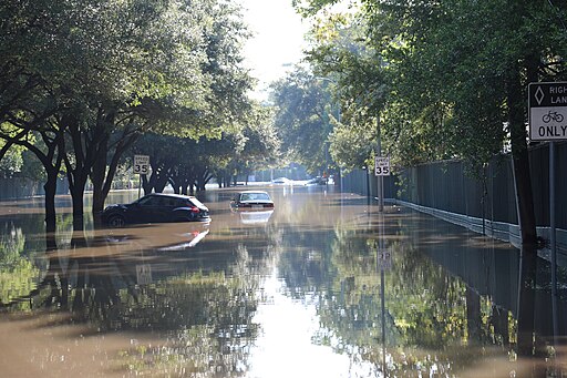
Real-time emergency response decision-making (DM) during flooding is a challenging problem. In contrast to the complexity of the problem, current DM frameworks are generally oversimplified and neglect the uncertainty, infrastructure performance and sociodemographics of the region. To address these limitations, this study poses a risk-informed DM framework that integrates situational awareness, exposure, vulnerability, and decision-making. First, real-time flood hazard information is obtained from a proven flood alert system. Next, the hazard data is coupled with performance models to estimate infrastructure performance at the component and network levels. Infrastructure performance is then placed in the context of sociodemographic data to inform decision making. In addition to proposing the integrated framework, this paper will present a case study application in Brays Bayou Watershed, Houston, Texas, USA. By quantifying risk and associated uncertainty, the framework can aid emergency managers seeking to identify high-risk locations and prioritize emergency response.
@inproceedings{panakkal2022risk,
  title = {Risk-Informed Decision-Making Framework for Emergency Response During Flooding},
  author = {Panakkal, Pranavesh and Padgett, Jamie E. and Bedient, Philip},
  booktitle = {13th International Conference on Structural Safety \& Reliability},
  year = {2022},
}
2020
-
 Accessibility and recovery assessment of Houston’s roadway network due to fluvial flooding during Hurricane HarveyAvantika Gori, Ioannis Gidaris, James R Elliott, and 5 more authorsNatural hazards review, 2020
The record-breaking rainfall produced by Hurricane Harvey resulted in catastrophic and prolonged impacts on Houston’s transportation infrastructure, inundating entire neighborhoods and rendering them inaccessible to emergency response services. Harvey highlighted the vulnerability of the roadway network to severe inundation during extreme fluvial flood events and emphasized the need for a detailed roadway network accessibility characterization in order to determine which areas of the city are most vulnerable and sensitive to transportation disruption. This study poses an integrated framework to evaluate fluvial flood impacts on roadway accessibility to emergency services experienced by potentially socially vulnerable populations. This framework is applied to assess the time evolution of road network accessibility during Hurricane Harvey through coupling of observed road closures, flood modeling, and network analysis. Furthermore, by analyzing network disruptions at the census block group level, the correlation between impact severity and social demographics of the affected areas is investigated. This analysis is conducted for two highly populated watersheds within the city of Houston, which have contrasting flood management infrastructure and represent a broad range of demographic groups. This analysis advances understanding of the interactions between flood extent and duration, infrastructure impacts, and community vulnerability by (1) assessing the evolution of network accessibility between emergency service locations and flood-impacted areas, (2) estimating the flood-induced increase of the emergency response travel times of the aforementioned origin-destination pairs, and (3) highlighting potential correlations between physical and social vulnerability.
@article{gori2020accessibility,
  title = {Accessibility and recovery assessment of Houston’s roadway network due to fluvial flooding during Hurricane Harvey},
  author = {Gori, Avantika and Gidaris, Ioannis and Elliott, James R and Padgett, Jamie and Loughran, Kevin and Bedient, Philip and Panakkal, Pranavesh and Juan, Andrew},
  journal = {Natural hazards review},
  volume = {21},
  number = {2},
  pages = {04020005},
  doi = {10.1061/(ASCE)NH.1527-6996.0000355},
  year = {2020},
  publisher = {American Society of Civil Engineers},
}
2019
-
 Towards enhanced response: Integration of a flood alert system with road infrastructure performance modelsPranavesh Panakkal, Andrew Juan, Matthew Garcia, and 2 more authorsIn Structures Congress 2019, 2019
This paper presents a conceptual framework for improved situational awareness in severe rainfall events like hurricanes or tropical storms by coupling a flood alert system (FAS) with a model for transportation infrastructure performance assessment referred to as the access to critical facilities (ACF) model. The FAS is a flood modeling and alert system that leverages state of the art flood modeling and rainfall radar data in an efficient manner. The ACF model comprises of a road network of the study area, census data, locations of critical facilities like hospitals and fire stations, and a spatial and network analysis toolbox written in Python. The proposed framework can be used to evaluate, in near real-time, system level performance such as accessibility to critical locations and component level performance such as potential impacts on roadways. As a proof of concept, the coupled framework is applied to the White Oak Bayou watershed, Houston, Texas. First, the hydrologic and hydraulic characteristics of the watershed are captured through inundation maps forming a floodplain map library (FPML). Second, five accessibility measures quantifying mobility and accessibility are evaluated for each inundation map to develop the accessibility map library (AML). During a storm event, real-time radar rainfall data is used to identify the pertinent scenario from the FPML and AML. The selected maps are then communicated to stakeholders to support emergency response and situational awareness. Further, the results from the framework can also be used for disaster mitigation planning. Although demonstrated on a single watershed, the methodology developed in this study is transferrable to other regions to develop an integrated flood alert system in support of emergency response and longer-term resilience goals.
@inproceedings{panakkal2019towards,
  title = {Towards enhanced response: Integration of a flood alert system with road infrastructure performance models},
  author = {Panakkal, Pranavesh and Juan, Andrew and Garcia, Matthew and Padgett, Jamie E and Bedient, Philip},
  booktitle = {Structures Congress 2019},
  pages = {294--305},
  year = {2019},
  organization = {American Society of Civil Engineers Reston, VA},
}
2018
-
 Post-Harvey Houston-Galveston roadway bridge reconnaissanceJamie Padgett, Georgios Balomenos, Ioannis Gidaris, and 7 more authors2018
Hurricane Harvey made a landfall on August 25, 2017 near Port Aransas, Texas, as a category 4 hurricane. Harris County experienced 33.7 inch (856 mm) of rain during a four day period, resulting in significant flooding, prompting controlled releases of surrounding reservoirs, and affecting transportation infrastructure across the region. The Padgett Research Group conducted a reconnaissance field survey on multiple days from September 1, 2017 to September 22, 2017 in the Houston and Galveston area to identify potential damages to roadway bridges caused by flooding and storm surge generated by Hurricane Harvey. A set of critical sites were selected based on maximum inundation depth and wave height predictions, flood gauge data, local media, personal communications and situational awareness tools. Field inspections were conducted for the select locations and the following were recorded: site accessibility, inferred inundation level, damages to pavements, abutments, piers, other structural and non-structural components, and debris effects. This project details the inspection observations, along with photos taken from site visits, and provides HazMapper layers that synthesize the observations. The dataset provides insight on common impacts of hurricane and flood events on bridges, and offers a foundation for future risk and resilience studies for transportation infrastructure.
@article{padgett2018post,
  title = {Post-Harvey Houston-Galveston roadway bridge reconnaissance},
  author = {Padgett, Jamie and Balomenos, Georgios and Gidaris, Ioannis and Ebad Sichani, Majid and Vishnu, Navya and Du, Ao and Bernier, Carl and Misra, Sushreyo and Kameshwar, Sabarethinam and Panakkal, Pranavesh},
  year = {2018},
  publisher = {DesignSafe-CI},
  doi = {doi:10.17603/DS2HM4H},
}